Monday 8 Mar Fairoaks (London) to Ajjacio (Corsica)
Delayed departure by 4 hours at Fairoaks due to a flat battery! Glad to be on our way with good weather and tailwinds. Quick turn-round at Ajjacio for fuel by basic but efficient ground services for night flight to Crete.
Ajjacio to Iraklion (Crete)
Fast flight (3 hrs) followed by instrument approach in poor visibility. Airport had been closed all day due to poor visibility from sand blowing from Sahara so our delay from Fairoaks had been fortunate. Everyone very friendly.
Tuesday 9 Mar Crete to Alaqaba (Jordan)
Vastness of Middle East desert quickly apparent with flight over Egypt – visibility poor. Became slightly concerned that ATC insisted we did not have authority to land in Jordan but they eventually agreed when I reminded them of our permission number. Friendly staff on the ground again. Fuel cheap!
Jordan to Bahrain
This leg was fast (3 hrs) with some comms problems in Saudi Arabia due to vastness of desert. Night landing at Bahrain with everyone friendly again but progress with everything very slow. Parked on other side of this busy international airport so some problems getting out! Lots of preparation for the Grand Prix at the weekend with the racing teams starting to arrive.
Wed 10 Mar: Bahrain to Muscat and Muscat to Ahmedabad (India)
I will never complain about paperwork after this!
Early start despite delay for fuel, followed by 4 hour leg to Muscat. Very hot with quick turn-round in Muscat. Very remote flight en route to Ahmedabad through Pakistan airspace. Midnight landing at Ahmedabad – Indian bureaucracy has to be experienced to appreciate!!
Only took 3 hours to get out of the airport but everyone charming. Taxi ride to hotel very hairy!
Thu 11 Mar: Ahmedabad to Patna and Patna to Chiang Mai (Thailand)
Fast flight up to Patna followed by instrument approach due to poor visibility. Indian bureaucracy still very much apparent – took 3 hours to get fuel and file flight plan! Night flight to Chiang Mai through very remote Bangladesh and Myamnar (Burma). Comms challenges but good weather and night landing in Thailand. Very efficient at Chiang Mai.
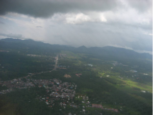
Sat 13 Mar Chiang Mai to Langkawi (Malaysia)
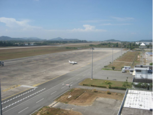
Langkawi’s huge runway in the background
Much needed break at Chiang Mai due to long days so far. Keeping to schedule so far. Early departure to Langkawi and no problems getting away despite no customs and immigration available when we landed here late on Thursday night.
Flight down to Langkawi good (3 hours) with some CBs developing and a decent tailwind. Instrument approach into this remote and friendly field.
Sun 14 Mar Langkawi to Batam (Indonesia)
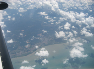
Passing Singapore
Flight routed past Kuala Lumpar and Singapore – some great scenery. Weather still reasonable and Batam clearly a very welcoming place. Lots of tourist aircraft traffic and pleased to be through another leg of this trip. Next stop, Bali….
Wed 17 Mar Batam to Bali (Indonesia)
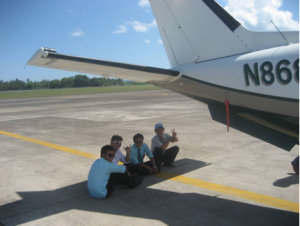
Groundcrew sheltering from the heat at Bali
Batam was very friendly indeed – and cheap. There had been very heavy rain during our stay in Batam.
Departed at 0900 for this 900 nm sea crossing. Some headwind and CBs (thunderstorms) on this leg. These became more active over Java and weather avoidance very necessary at times. Very pleased to be in Bali despite heat (33 degrees C) and on track so far – it now seems very close to Australia. The next legs on Fri are to Darwin. Plans to route through Cairns have been abandoned since there is a typhoon approaching there!
Fri 19 Mar Bali to Darwin
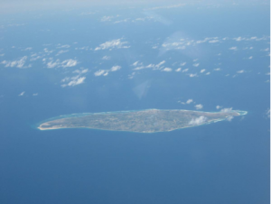
One of the many idyllic uninhabited islands on this leg
This was an early start and would be one of the longest legs so far. There were a few alternate airports en route but it felt lonely particularly when VHF comms dropped out for 100 miles or so between Indonesian and Australian airspace. HF fit is not mandated but it would be nice to have! The weather was fair except for some heavy rain-showers near Darwin.
Customs and quarantine regulations are very strict here and they required all documents to be presented in their main office in the city before onward travel.Since this was Friday afternoon and they had just shut for the weekend, we would be in Darwin until the offices opened on Monday morning!
Mon 22 Mar Darwin to Mount Isa
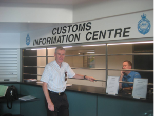
Customs clearance in Darwin on Monday morning
Having presented the aircraft documents to Customs in Darwin at 0800 on Monday morning, there was a lot of ground to cover to get to Brisbane (1800 nm) today. One’s mortality and the dangers of aviation were brought home when the aircraft that had lined up in front of us, crashed on take off.
It was an Embraer 120 – a 30 seat twin engine turbo prop. It was on a training flight and it is thought the crew were practising engine failure drills on take off – unfortunately they were both killed. Thinking that the airport would be closed for some time, we were released after holding for only 20 minutes.
Lots of cloud and headwind from Cyclone Ului which had now crossed the coast south of Cairns. The huge expanse of Australia becomes clear on this leg. VHF communication with Brisbane control is surprisingly good in all areas. Mount Isa is a delightful mining town in the middle of nowhere!
Mount Isa to Brisbane/Archerfield
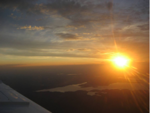
Arrival at sunset – Brisbane/Archerfield
This is the last leg and therefore pleased to get a quick refuel at Mount Isa. Another 4 hour flight but the headwind reduced and we managed to get to Brisbane just after sunset. There was a fantastic sunset behind us – very satisfied to have all legs successfully completed.
My commercial flight back to UK is on Tue morning – only 12 hours to spare! 10500 nm covered so far and nearly 50 hrs flying. The aircraft will be hangared in Brisbane until the end of Apr when I will return to complete the circumnavigation route to London via Papua New Guinea, Philippines, Japan, Alaska, Canada, USA, Greenland, Iceland.
Thursday 29 Apr Brisbane/Archerfield to Albury
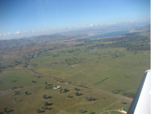
Rolling landscape near Albury
The aircraft had been parked at Brisbane Archerfield since early March. Everything checked out well and it was great to get on our way at last. The weather was excellent – clear VFR all the way on this 800 mile leg taking me close to Melbourne.
Archerfield is a very busy and efficient general aviation field. It was much cooler in Albury – rolling hills and getting used to the fact in the southern Hemisphere that it gets colder as you travel south!
Sat 1 May – Albury to Broken Hill
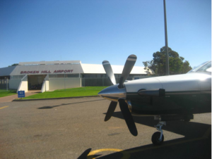
Broken Hill Airport – a valuable resource to the local community
Albury Airport is typical of Australian rural airports – GPS approaches, pilot activated lighting and CTAF radio, with irregular commercial flights and Flying Doctor Service flights supporting the local community. This 800 mile leg was northwards closer to the heart of Australia – getting hotter!
Broken Hill to Ayers Rock
This leg was only 430 miles but one could see the change in terrain and the geological formations which had formed Ayers rock and the Olgas. They were clearly visible more than 50 miles away in excellent visibility; and they were increasingly more impressive on approaching them. 34 degrees on the ground although cool in the evening.
Sun 2 May Ayers Rock to Tennant Creek
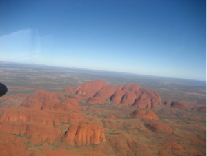
The impressive Olgas with Ayers Rock in the background
Tennant Creek is a very isolated small town on the way to Darwin some 500 miles north of Ayers Rock. Stifling hot (35C), with no breeze and lots of flies (where do they come from?!).
Thankfully, no need for fuel here since it is only available in barrels. The locals were also using the runway for their annual drag racing event. Landed between races, courtesy of a very obliging ground controller!
Tennant Creek to Darwin
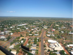
Downtown Tennant Creek
This last leg today to Darwin was fast with gathering cumulus clouds and the landscape noticeably getting greener in the final 150 miles. The final approach on runway 11 was poignant since it was here I had witnessed that doomed Embraer 120 aircraft in March.
Australia had provided excellent flying; good weather on the whole and obliging air traffic controllers. Although there is no radar coverage over most of the country, VHF communications is excellent, even on the ground to the Brisbane/Melbourne controllers.
Tue 4 May – Darwin to Manardo (Indonesia)
Approach to Manardo with heavy rain clouds looming
Darwin is a good stepping off point from Australia across the Pacific as we head north east bound to Indonesia. This 900 mile leg was over wide expanses of water with some idyllic islands and limited radar coverage. As the afternoon progressed, there were gathering CBs which required careful avoidance.
The approach to Manardo was interesting since the controller requested a descent into cloud with rising ground and without any radar cover. I elected to do a let down over the sea! Steaming heat here just at the equator.
Manardo to Manila
This was a similar distance leg over sea with a great deal of traffic en route to various holiday spots. Again, a lot of weather about that needed to be avoided. Manila is a huge city and the airport is very busy. Arriving in the late afternoon, it was still 36 degrees. The city was getting ready for their elections later this month. Traffic is a nightmare here!
Wed 5 May – Manila to Okinawa (Japan)
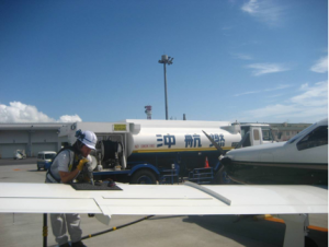
Japanese efficiency
Departing Manila without getting heat exhaustion is a challenge since the temperature was already 30C by 0900. The aircraft is even hotter and it took some time to get permission for start and to get air conditioning operating effectively.
The route to Okinawa is similar to yesterday’s – long stretches over the water although the controllers are easier to understand and there is now effective radar coverage. The area near Okinawa is synonymous with second war battles. It is certainly a well developed island with excellent facilities.
Okinawa to Osaka
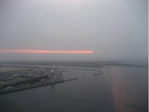
Sunset arrival at Osaka
This 800 mlle final leg today was tiring as we travelled further north over the mountains of central Japan. Good views of the cities, arriving just after sunset. Osaka is an extremely efficient and a well organised airport with a monstrous terminal.
It has been built on reclaimed land just off the mainland. Charming service offered by the airport staff. The airport seems capable of handling huge amounts of traffic.
Thu 6 May – Osaka to Sappora (Chitose)
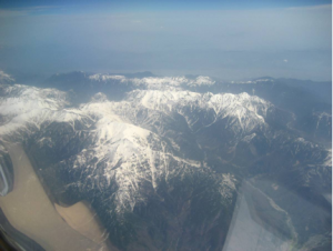
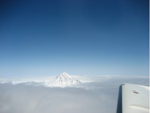
Mountains in northern Japan.
This was a relatively short leg of 550 miles towards the north of Japan. It had now cooled to 10 degrees and snow had fallen last week here. There were splendid views of the snow capped mountains on our way up north.
Fri 7 May – Sappora (Chitose) to Petropavlovsk
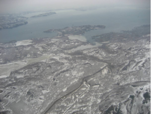
Russia’s frozen landscape
This would be the most challenging day of the trip so far – to get through Russia and on to Alaska without staying over in Russia since we did not have Russian visas. The Japanese handling agent had brought forward our departure time to 0800 since it was necessary to get to the Aleutian Islands before dark this evening as the airport would be closed.
A take-off with a 400 foot cloudbase in heavy rain for this 900 mile leg to Russia. On reaching the Japanese FIR, Russian controllers with thick accents gave flight level instructions in meters (instead of feet) which required conversion by calculator (which decided to pack up!).
The Russian landscape looked very cold and forbidding, particularly around this mining area of Petropavlovsk. On arrival the aircraft was surrounded by unsmiling security officials wearing leather jacket; they seemed fresh from the cast of from Russia with Love!! They meticulously checked all documents. Despite a delay, the flight plan was finally approved.
Petropavlovsk to Adak (Aleutian Islands)
Adak peeping out from beneath a blanket of cloud
Another 940 mile leg across to the western tip of the Aleutian islands. These islands are part of Alaska, several of which were occupied by the Japanese in 1942 and saw bitter fighting. It was comforting to be under Anchorage radar control after leaving Russian airspace although facing 50 knot headwinds.
I had arranged for fuel at Adak and to arrive at sunset although Customs & Immigration at Anchorage insisted that we must depart immediately after refuelling at Adak in order to clear customs in Anchorage. These islands suffer very unpredictable weather and the approach aids are limited in Adak so it was a relief to get confirmation of suitable weather reports from Anchorage’s controller otherwise a diversion to the US military base at Shemya would have been necessary.
I arrived at Adak at sunset with the island in cloud and a GPS approach as an aid. The ground controller advised keeping an eye out for migrating geese! This is a beautifully bleak island which attracts fishing and hunting trips. The airport manager drove us to his house nearby for coffee and cookies with his wife before departing for Anchorage at midnight.
Adak to Anchorage
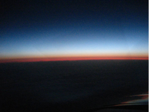
Sunrise approaching Anchorage (Alaska)
US airfields are very efficient. Here at Adak, although it was closed, there is pilot activated lighting for the taxiways and runways, and Anchorage ATC some 1200 miles authorised our GPS procedure departure whilst we were on the ground. Climbing into the pitch blackness at midnight and finally above the cloud at 12000 feet to enjoy a very starry sky and smooth flight conditions for this 5 hour flight.
In these northern latitudes at this time of year there is only 4 hours darkness per day. Enjoyed a fantastic sunrise on approach to Anchorage. This is a beautiful city surrounded by panoramic mountains. Had covered some 3100 miles today and landed before departing Japan some 14 hours ago due to crossing the International dateline!
Sun 9 May Anchorage to Ketchikan (Alaska)
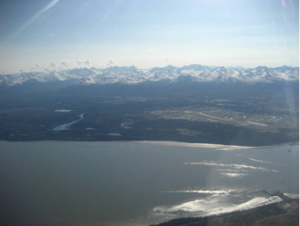
Anchorage on departure
It had been a very welcome rest in Anchorage. A beautiful city surrounded by majestic mountains. I had taken the opportunity to rent a Cessna 172 from the local flight school in order to revalidate my US licence (BFR) – due at the end of the month. This leg to Ketchikan was some 800 miles and the flight along the Inside Passage – wonderful scenery.
This small town in southern Alaska originated in supporting the salmon canning industry but now is crowded with souvenir shops selling to visiting cruise ships.
Mon 10 May – Ketchikan to Great Falls (Montana)
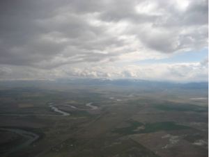
Big Sky Montana
This leg stretched the length of the Rockies and through Canadian airspace. For most parts the weather was excellent and afforded fantastic views. Great Falls is an interesting large town, proud of its western heritage; not far from Little Big Horn. One can understand why it is called “Big Sky Montana”
Tue 11 May – Great Falls to Duluth (Wisconsin); Duluth to Buffalo (Niagara)
Travelled some 1600 miles today through mostly high level clouds and some moderate icing. A shame not to see the Great Lakes. ATC was very efficient and obliging in giving direct clearances to reduce time.
Wed 12 May – Buffalo to Goose Bay (Newfoundland)
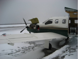
Arctic conditions in May!
The flight to Goose Bay gave some views of the Canadian landscape, Quebec and the St Laurence estuary. Had been hoping to have a VFR tour of Niagara Falls, close to Buffalo airport but the cloud base was 500 ft and there was no chance of that. Arrived in Goose Bay in sleeting rain and low cloud conditions.
There were a number of aircraft that had diverted here and several F16s from the Turkish Air Force en route to their exercise in northern Canada. A check with the met office for the conditions tomorrow predicted heavy snow in the evening. This would prove to be accurate!
Thursday 13 May – Goose Bay to Narsarsuag (Greenland)
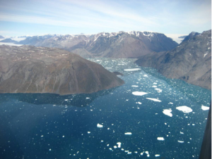
Fjord at Narsarsuag
Departed Goose Bay in solid IFR conditions having had a splendid display of three F16s taking off just before – disappearing into the cloud with afterburners full on. Our departure was not quite so fast and the predicted tail wind was 50 knots on the nose! It was clear by the time Greenland was reached that a fuel stop there was necessary.
Narsarsuag to Reykjavik (Iceland)
On the final leg today to Reykjavik, finally the tailwinds predicted earlier were evident. This 700 mile leg was quick. The handling agent at Reykjavik said that their volcanic ash cloud might be affecting the airport after midnight and it might have to shut. This was the case and a pleasant day was spent touring Reykjavik on Friday.
Saturday 15 May – Reykjavik to Fairoaks (London)
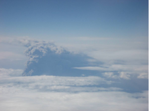
Volcanic ash plume rising through clouds in Iceland
Departure from Reykjavik was carefully managed by ATC to avoid the volcanic ash plume which had been blown to the south of the island. This could clearly be seen in the distance. Strong tailwinds gave a fast flight to Fairoaks – just over 4 hours to cover 1000 miles.
It was strange coming back home; familiar ATC accents and places through Scotland and England, and great weather! Farnborough even offered radar vectors for Fairoaks. The trip had been over 25000 miles in 90 flying hours. A fantastic experience.
-
- The final leg to Fairoaks (London) from Reykjavik
-
- Approach in to Fairoaks
-
- Home at last
Thank you everyone for donations and support for Help for Heroes charity.